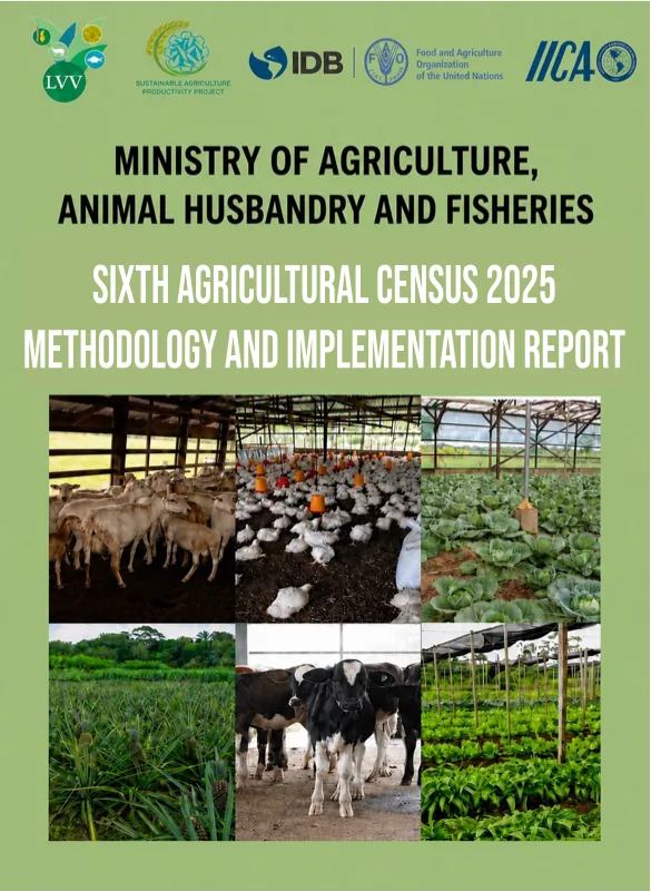
What was the agricultural census?
10 districts
A nationwide picture
The first agricultural census since 2008 collected information about agricultural holdings throughout Suriname.
What was the agricultural census?
10 districts
The first agricultural census since 2008 collected information about agricultural holdings throughout Suriname.
When did it take place?
Jan – Mar 2025
Land and livestock were counted as they stood on 13 January 2025, giving every interview the same point in time.
How was information collected?
CAPI
Data were collected using CAPI on tablets — the first time this data-collection method was used for an agricultural census in Suriname, with checks built directly into the questionnaire.
How large was the field operation?
123
The interviewers and supervisors carried out the census under the coordination of the Ministry of Agriculture, Livestock and Fisheries (LVV).
How many holdings were counted?
14,409
The results describe agricultural holdings across all ten districts, using approaches adapted to the coastal plain, Paramaribo, and the interior.
What else did the census measure?
SDG 5.a.1
A dedicated module supports reporting on women’s ownership and control of agricultural land.
A census is more than a count of farms. It is the reference point for understanding long-term change and for building a statistical system that can keep producing current agricultural information.
The new figures can be compared with earlier censuses, especially 2008. This reveals changes in agricultural holdings, land use, production systems, and the people working in agriculture.
National, district, and local information helps guide decisions about land, irrigation, advisory services, food security, and rural development.
The census created an up-to-date list of agricultural holdings. This makes smaller, lower-cost surveys possible, so information can be updated more often without asking every farmer to take part each time.
Census results provide a reliable point of comparison for the records collected by the Ministry and can help identify missing or outdated information.
The census asked who owns or holds rights over agricultural land. This makes it possible to examine differences between women and men and where secure land rights may be lacking.
The census counted agricultural holdings — the basic units for which information was collected. What mattered was who managed the agricultural activity as one unit, not a single piece of land.
An agricultural holding is all the land, animals, and other agricultural activities managed as one unit by the same person, household, group, or organization.
One management
Agricultural activities
Fieldworkers first asked every household or organization a short set of screening questions.
An economic unit of agricultural production under single management, comprising all land and livestock used wholly or partly for agricultural production, regardless of ownership, legal status, or the number of parcels and locations involved.
One threshold was enough. Ten chickens, one cow, or a hundred square metres of cassava made a household an agricultural holding.
Crops and land
Livestock and bee-keeping
Aquaculture
Answers from units that stayed below every threshold were still kept, to measure coverage and build the farm register.
The same approach would not work everywhere. Agricultural activity, settlement patterns, travel distances, and accessibility differ greatly between the coast, Paramaribo, and the interior.
Coastal and accessible areas
Fieldworkers covered Wanica, Commewijne, Saramacca, Coronie, Nickerie, Para, and the accessible part of Marowijne used two approaches: accessible coastal areas were covered completely, while remote interior villages were selected. completely.
Fieldworkers went door to door, screening every household and organization. Every agricultural holding that qualified received the full questionnaire.
Paramaribo
Agriculture is more scattered in the capital. Fieldworkers therefore visited 47 of Paramaribo’s 472 neighbourhood blocks—about one in ten.
Every household and agricultural holding inside each selected block was approached.
The interior
Travel distances and access make visiting every village impractical. Villages were therefore selected in Brokopondo, Sipaliwini, and the remote part of Marowijne used two approaches: accessible coastal areas were covered completely, while remote interior villages were selected..
The largest villages were always included. In every selected village, all households were screened.
How the wider picture is calculated
Selected blocks and villages were chosen using a structured method, not simply because they were easy to reach.
Neighbourhood blocks or villages are selected in a way that reflects the wider district.
Within every selected area, fieldworkers screen all households and interview every qualifying agricultural holding.
During analysis, those answers receive the correct share based on how much of the district each selected area represents.
Combined with the completely covered areas, this produces reliable district and national results without requiring fieldworkers to visit every remote or urban location.
Interviews were conducted face-to-face and answers entered directly on a tablet. The interview followed a clear order, showing follow-up questions only when they matched an earlier answer.
The first questions asked whether anyone in the household grew crops, raised animals or bees, or practised aquaculture in 2024. The fieldworker then checked whether the activity was large enough to be included.
Where did the activities take place? Was the holding run by one person, several people, or an organization? And who was the holder or manager?
The interview continued with total area, separate parcels, land use, crops, and irrigation. Livestock keepers were asked which animals were present on the reference day and how many.
It also covered the people working on the holding, machinery used, buildings, financial support, and the manager’s agricultural education.
Before closing the interview, the tablet helped the fieldworker check missing or unusual answers. The respondent could also add comments.
An agricultural census looks like three months of fieldwork. Almost two years of preparation came first: every question was written, discussed, tested with farmers, rewritten, and tested again.
March 2023
The Ministry and the FAO review the 2008 questionnaire, compare it with the international standard, and add what matters now: greenhouses, hydroponics, bee-keeping, and women’s rights to agricultural land.
Through 2023
Consultation with the Ministry’s divisions, the ressort offices, and FAO census specialists. Crop lists, animal species, and land-use categories are rewritten to match how people actually farm in Suriname.
Sept – Oct 2023
An FAO expert spends ten days training Ministry staff to build and supervise a census on tablets. The Ministry had never collected data fully digitally before.
November 2023
The working group takes the draft questionnaire to 50 farmers in Wanica, in two rounds. Questions that read well at a desk turn out to need rewriting in a farmyard.
20 May – 9 June 2024
Twenty staff run a complete pilot census across twelve areas in Commewijne and Marowijne, including river crossings by boat. Questions, tablets, training, workload, and logistics are all tested in practice.
Late 2024
The questionnaire is revised once more, the tablet programme rebuilt to match, and the training materials finished. Nationwide fieldwork begins in January 2025.
A completed questionnaire did not immediately become a final figure. The answers passed through several checks before entering the results.
The tablet flagged missing, impossible, or unusual answers.
Supervisors reviewed questionnaires and returned them for follow-up when needed.
The data team looked for duplicates, missing information, and answers that did not match.
A separate follow-up in selected areas checked whether holdings were missed or counted twice.
Personal information remains protected; the website shows only combined results.
Each step reduced the chance of an error reaching the final figures.
The census is not an endpoint. It created an up-to-date list of agricultural holdings. This allows smaller surveys to run more often, at lower cost and with fewer questions for farmers.
The starting point
A new national benchmark and an up-to-date list of agricultural holdings.
Shorter crop and livestock surveys can follow changes every year.
Only a smaller group of agricultural holdings needs to be contacted for each focused survey.
New figures can be compared with 2025 to show where agriculture is changing.
The next step is already underway
April 2026The first annual crop and livestock survey using the new census list was conducted.
The Sixth Agricultural Census was a national operation led by the Ministry and supported by national and international partners.
Leadership & implementation
Including the Census Working Group, district offices, fieldworkers, and supervisors.
Technical support
Support for methodology, training, the digital questionnaire, and data processing.

Financial support
Through the Sustainable Agricultural Productivity Program (SU-L1052).
Digital infrastructure
The digital environment used for secure receipt and storage of the data.

Role to be confirmed
IICA appears on the report cover; its precise contribution still needs confirmation.